


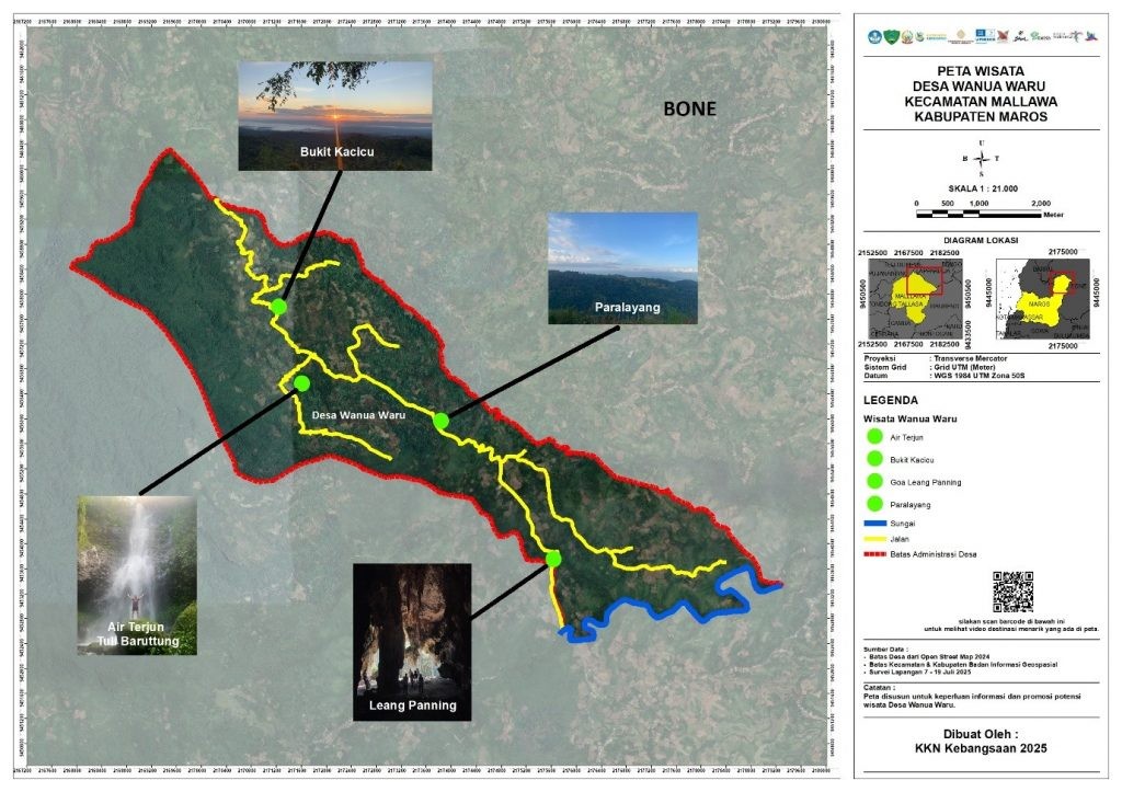
Maros, July 27, 2025 – Wanua Waru Tourism Village, located in Mallawa District, Maros Regency, South Sulawesi, is known as a hidden gem with diverse tourism potential. Highlights include the prehistoric Leang Panning cave—where the 7,200-year-old skeleton of a woman named Besse was discovered—along with the three-tiered Tuli Baruttung Waterfall, the green panorama of Kacicu Hill, and the adrenaline-pumping Batu Massong paragliding site.
Despite its wealth of natural and historical attractions, the village has lacked a proper tourism navigation system. Visitors have relied on directions from locals, as no official map was available to guide their journeys.
Addressing this issue, Syifa Nurul Jannah, a student of Surveying, Mapping, and Geographic Information Studies at Universitas Pendidikan Indonesia and a participant in KKN Kebangsaan XIII, designed a tourism map for Wanua Waru. The map aims to help both tourists and residents explore the village’s main attractions more easily.
“This map is designed to help local communities and visitors identify each destination. We hope it can serve as both a guide and a marker for tourism potential worth developing further,” said Syifa.
The map combines clear information with engaging visuals, featuring icons of sites such as Leang Panning, Tuli Baruttung Waterfall, Kacicu Hill, and the Batu Massong paragliding point. Printed copies have been framed and displayed at the Wanua Waru Village Office, while roadside information boards ensure visibility for travelers.
With this initiative, visiting Wanua Waru is expected to become a more guided and enjoyable experience. The project also reflects the tangible contribution of KKN Kebangsaan XIII students to village development—not only in education and social aspects but also in tourism promotion and management. (contributor)